In this, the first of our planned Parhelion Aerial Postcard series, we report on conditions after flooding of the Bielersee, in Switzerland.
Biel is a small city located at the eastern end of the Bielersee, a sizable lake in Switzerland that has overflowed its shores and flooded nearby lowlands in places due to recent heavy rains. This lake is close to the home base of Parhelion Aerospace, and therefore a great place to begin our Parhelion Aerial Postcard articles series.
Biel is an ancient city.
It was chartered in 1275, but was inhabited as early as pre-Roman, Celtic times. The city proper has a population of about 55,000 inhabitants (estimations vary), and is part of the Canton of Bern. Biel is known for watchmaking, with Rolex, Omega and others having business premises here. It has a bilingual official name: “Biel/Bienne,” reflecting the languages of the most numerous inhabitants.
Biel is bounded on its western side by the Bielersee, or Lake of Biel. The lake is located at about 430m above sea level and has a surface area of about 40 square km – so it is not a small body of water at all. The lake forms by input from the river Aare (the longest river entirely in Switzerland) as it comes down from the Alps, and by local runoff from the Jura Mountains that run along its northern shore. The Aare comes in to the Bielersee at the southwestern quadrant of the lake and goes out again from the southeastern quadrant.
We've had a plague of rainy weather this summer.
Due to a recent, prolonged period of unseasonable, cool and rainy weather (MeteoSuisse reported that it has already rained more in July 2021 than in any July on record), the Bielersee rose above its southern shore and flooded the nearby land. One report had the lake rising 60cm in a single week this month, achieving an official Risk Level of 5, which is the maximum. The Swiss Federal Office for the Environment (FOEN) states that a Risk Level 5 event occurs only once per century, on average.
The water level in the Bielersee has now dropped somewhat from the high achieved in the middle of the month. Damage from the floodwaters can now be assessed, and it was for this reason that we set out to visit the Erlenwaeldli (little Erlen forest – yes, it does sound like something out of Lord of the Rings) in Ipsach, a suburban community that is part of the Biel metro area. The Erlenwaeldli is a walking park and football fields area on the south shore of the Bielersee, adjacent to the lake’s outflow point, and so necessarily a low area prone to flooding. Drone aerial imagery is perfect for this sort of analysis, so we packed the Mavic 2 Pro and drove to Ipsach to see just how bad it was.
Flood damage was obvious.
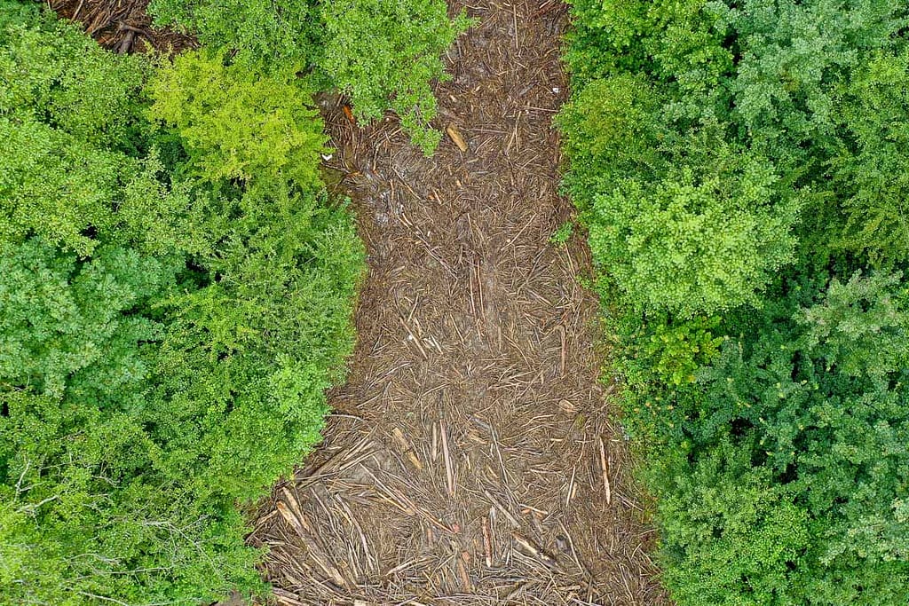
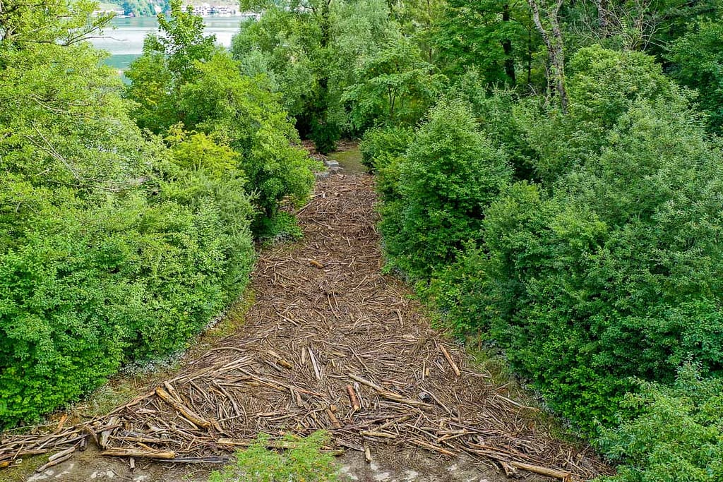
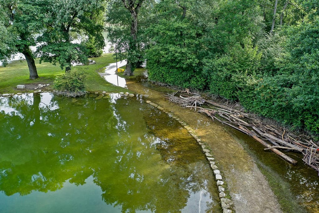
What we found in that location consisted primarily of drift debris, mostly logs, tree branches and the occasional nearly entire tree, cast up on the playing fields in large piles. Additionally, the walking trails through the forested part of the park were either covered with a thick carpet of driftwood or were still flooded. These conditions were captured well by the Mavic, as you can see here:

Wooden flood-debris on a park walkway

Flooded paths in the Erlenwaeldli Park
The walking, swimming, sunbathing and grilling areas are, at the moment, unavailable for use due to being covered by flood debris or water. Some of the playing fields are also of only limited use. We did see some fishermen at their hobby – the floods have not stopped them – one even descried how fish had come up into one of the football fields and could be then caught with nets. He seemed to be a little disappointed that the water, and the fish, had gone back out again!
The aerial perspective, or “view from above” reveals how the debris lie in relation to the landscape. Such information is valuable to anyone interested in making a plan to remove the material and to restore the park to its full usefulness and beauty.
The Swiss news outlet ‘Schweizer Radio und Fernsehen’ (SRF) recognized this point, and published one of our aerials yesterday as an online cover story and again on its ‘Meteo page:

The Mavic 2 Pro that we use for some types of work proved a valuable instrument in documenting newsworthy events such as the flooding of the Bielersee, and provided us the opportunity of sending you this first Parhelion Aerial Postcard. Wish you were here.
Parhelion Aerospace provides drone aerial imagery services that give you that useful “view from above.” Contact us if you need aerial imagery in Switzerland.