In this Aerial Postcard we take you to the Naturpark Gantrisch, near Thun, Switzerland.
In early September we drove from Parhelion HQ to the Naturpark Gantrisch, which is not far from the city of Thun.
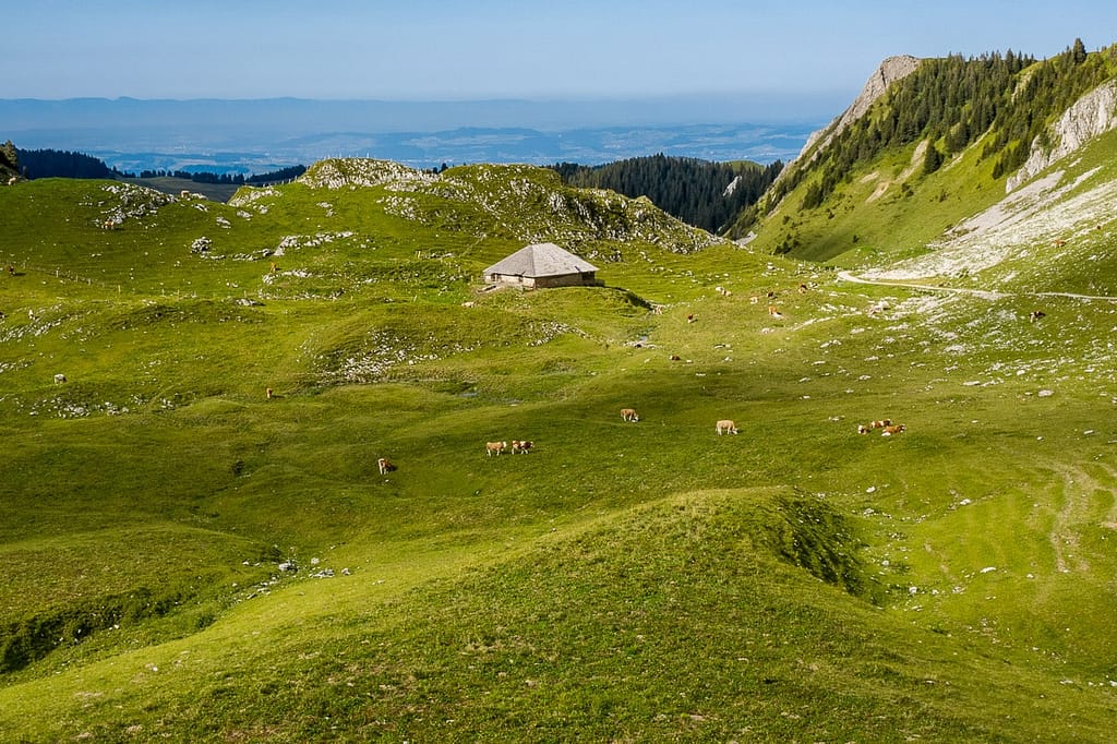
The Naturpark is really an agricultural region of the Canton Bern, in which there are many picturesque villages and farms and some spectacular, grassy and cliffy peaks, rather than solely a nature park, as the name would imply. In fact, driving south out of Belp, the town that hosts the Bern airport, one is immediately in the Naturpark Gantrisch, even though nothing is really different to the eye than would be found in any other area of farming villages elsewhere in the pre-Alps part of the Canton.
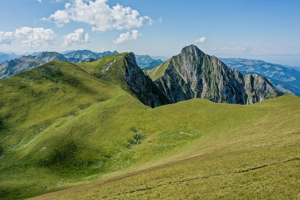
The drive becomes increasingly scenic, however, the farther one goes to the south. The roads are generally small, and their many rises and falls, as well as the countless bends and twists pull motorcyclists in like magnets (and they are, consequently, everywhere). From the beautiful town of Riggisberg the road winds through farms and forest until it arrives at the Gurnigelpass, where the first panoramic view of the peaks country, immediately to the south, can be had. The several peaks that define the southern boundary of the ‘park’ stand up like a line of well-spaced teeth, separated by open valleys. This stunning terrain is the real attraction of Naturpark Gantrisch for tourists, and presents an irresistible lure to drone flying and aerial imagery-making, which we, of course, could not resist.
We followed the Gurnigel Road another 2km to the south and arrived at the Gantrischhuette, a large tourist restaurant located beside a tight bend in the road. We parked and set out to climb into the peaks country from the public parking there (beware: parking is available for hikers but it is not free – you will get a CHF 40.00 fine for not paying the on-site machine).

It's an easy climb.
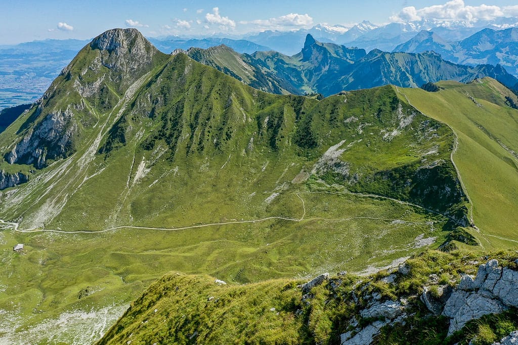
From the Gantrischhuette we walked along the well-marked path to the south and climbed up through grassy fields between towering cliffs to the Morgetepass (1959m), a saddle in the ridgeline that connects the peaks of the area. The hike takes around two hours, depending on your pace, and is an easy climb. Immediately to the east of the Morgetepass rises the stony knob of mount Gantrisch itself (2175m), from which the Naturpark is named. Along the ridge to the west lies the slightly less towering Burgle peak, at 2165m. The Morgetepass has its own little kiosk, where you can take local products, such as cheese and sausages, out of one box and leave payment in another. There was no attendant when we were there: only in Switzerland! The sausage was excellent.
The weather was perfect, and from a spot above and to the immediate west of the Morgetepass the entire ridgeline, with its array of bald peaks, lay open to view. It is an ideal place to fly drones and to take aerial images.

A word about the geology of the Gantrisch peaks area:
The Naturpark Gantrisch is located within the Klippen nappe, a heavily folded and thrusted geologic region that is made up of Mesozoic carbonates, marls and shales. More specifically, the peaks of the Gantrisch area consist of an Upper Jurassic massive limestone member of the Klippen nappe sequence, deposits of which reach up to ~400m in thickness in places (see Structure of the eastern Klippen nappe (BE, FR): Implications for its Alpine tectonic evolution, 2002, Wissing, Pfiffner).
The present form of the peaks-and-valleys arrangement, producing the spectacular skyline panoramas that give the Naturpark its particular charm, results from some faulting but also considerable glacially-induced erosion. Limestone scree covers the lower slopes of the peaks, which are, in turn, covered by Quaternary soils and generally low vegetation.


You can't beat the view.
From the summit of the Gantrisch peaks it is possible to see a magnificent view in any direction. In particular, a very fine panorama of the high Alps (e.g. Jungfrau, Lauterbrunnen Breithorn), forms the horizon to the south, daring the traveler to attempt greater things!
We flew until the batteries ran out of power, disturbing no one, since no people were in sight most of the time. In the end, we reluctantly climbed back down the way we had come and returned to Parhelion HQ, demonstrating that Gantrisch is an easy day-trip for anyone within the Canton Bern region.
The Mavic 2 Pro that we use for some types of work proved a valuable instrument in documenting the beauty and appeal of the Naturpark Gantrisch, due to its easy portability and superb camera, and provided us the opportunity of sending you this Parhelion Aerial Postcard. Wish you were here.
Parhelion Aerospace provides drone aerial imagery services that give you that useful “view from above.” Contact us if you need aerial imagery in Switzerland.